
Divoox Flex: route distance and times, and “Navigate the route”
Every route shows its road distance, driving time and the arrival time at each stop; the driver opens all the stops in order on the map with one tap.
How it works
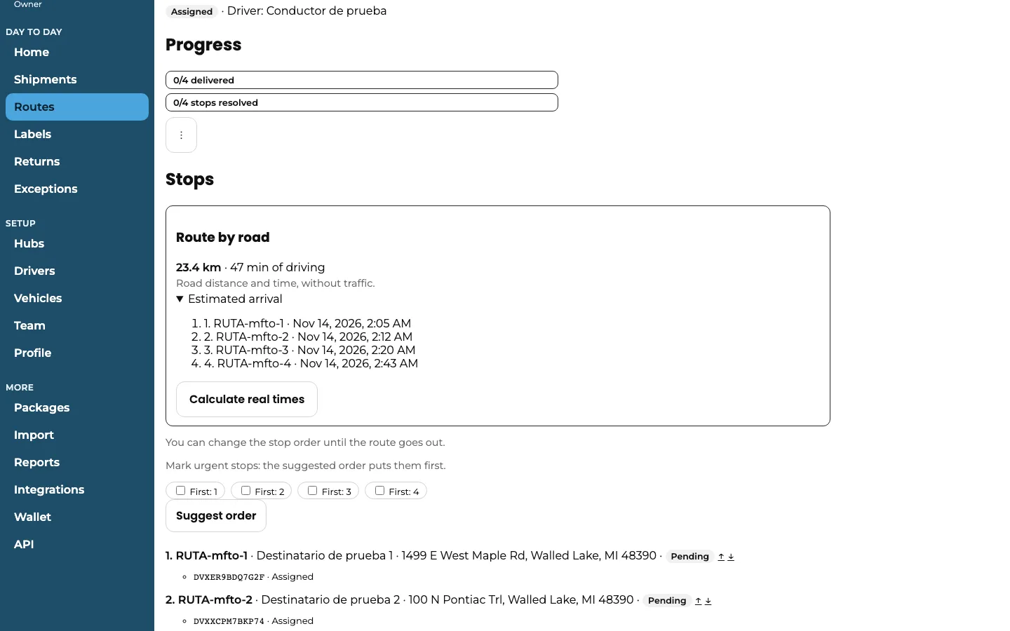
In a route’s detail page, the “Route by road” card shows the total distance and driving time, measured by road and without traffic. Under “Estimated arrival” you see the approximate time the driver reaches each stop, counting a few minutes at each delivery.
It’s calculated automatically when you assign or offer the route. If you change the order of the stops before it leaves, tap “Calculate real times” to update it; if the order didn’t change, it isn’t recalculated.
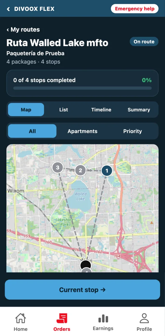
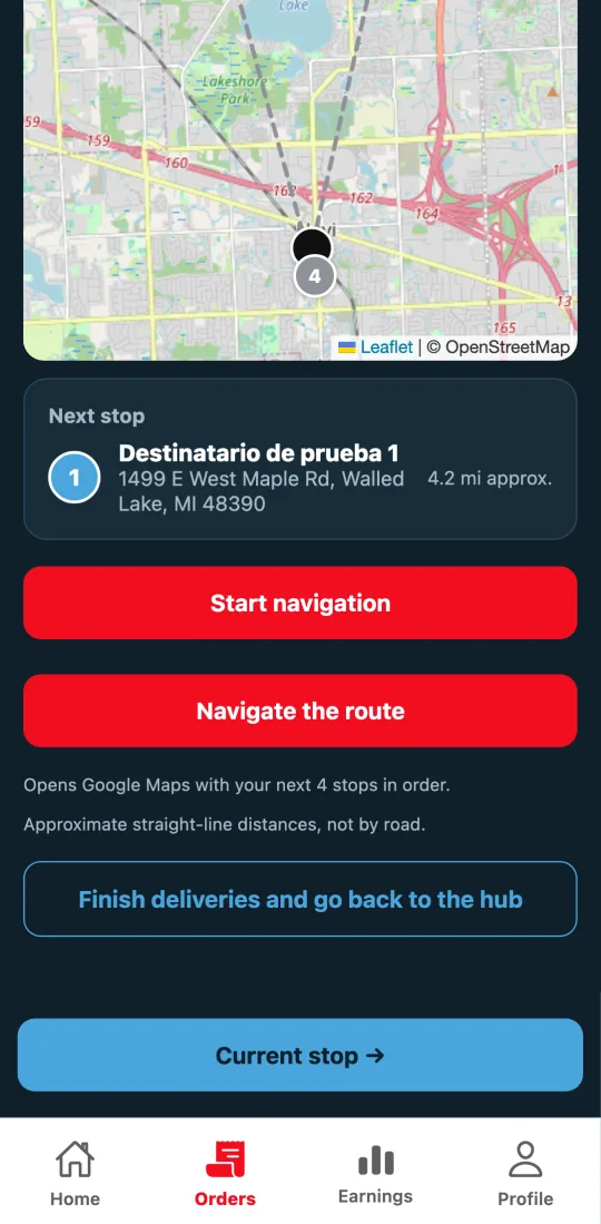
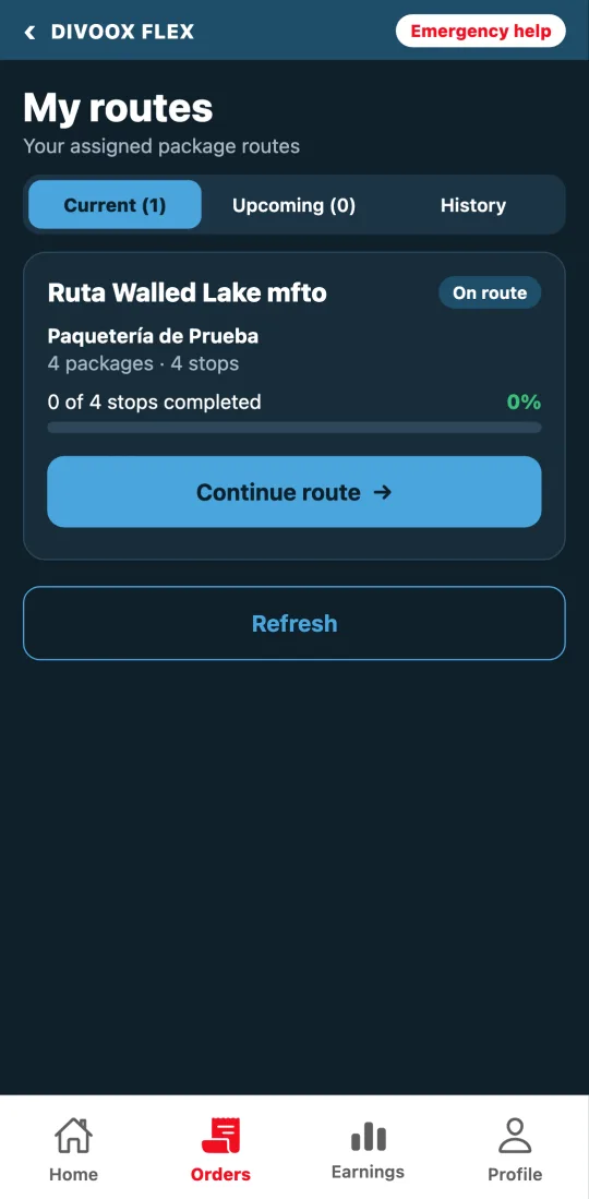
In Divoox Driver, the driver opens “My route (packages)”, goes into the route and, on the “Map” tab, sees all the numbered stops and the next stop with its approximate distance.
“Start navigation” takes them to the next stop. “Navigate the route” opens Google Maps with the next stops in order, up to 10 at a time; once those are done, tapping it again opens the next ones. Waze and Apple Maps only take one stop at a time.
These same estimated times are what the recipient sees on their package’s tracking page.
Steps
- Assign or offer the route: distance and times are calculated automatically.
- In the route’s detail page, check “Route by road” and open “Estimated arrival”.
- If you changed the order of the stops, tap “Calculate real times”.
- The driver opens “My route (packages)” in Divoox Driver and goes into the route.
- On the “Map” tab, they tap “Navigate the route” to go stop by stop.
The distance the driver sees next to each stop is approximate, in a straight line; the one in the dashboard is by road.
This guide answers
- How many miles or kilometers is my route?
- What time does the driver reach each stop?
- How does the driver open all the stops in Google Maps?
- What do I do if I changed the order of the stops?